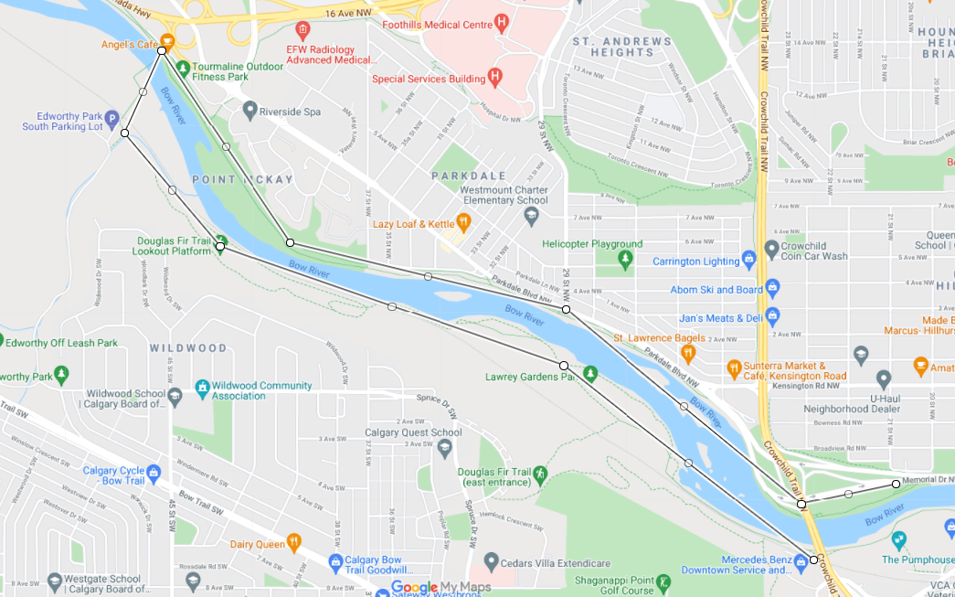
Calgary’s Bow River Pathway: Crowchild Trail to Edworthy Park Loop
Back in September 2019, I blogged about how the 12 km south shore of Calgary’s Bow River Trail from Edworthy Park to Harvie Passage is one of the best river banks in North America. In it I focused on the many made-made improvements located on the south bank of the majestic Bow River - the plazas, playgrounds, skate parks, pebble beaches, public art, surf wave, pedestrian bridges etc.
In this blog, I attempt to capture some of the natural elements of the Bow River experience from Lawrey Gardens to Edworthy Park on the Bow River’s south shore, as well as the man-made elements on the north side from Edworthy Park to the Dave Freeze pedestrian bridge and a bit beyond. An 8-kilometer loop.

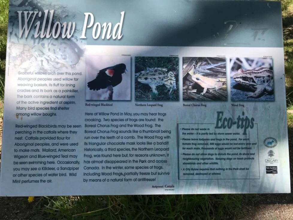
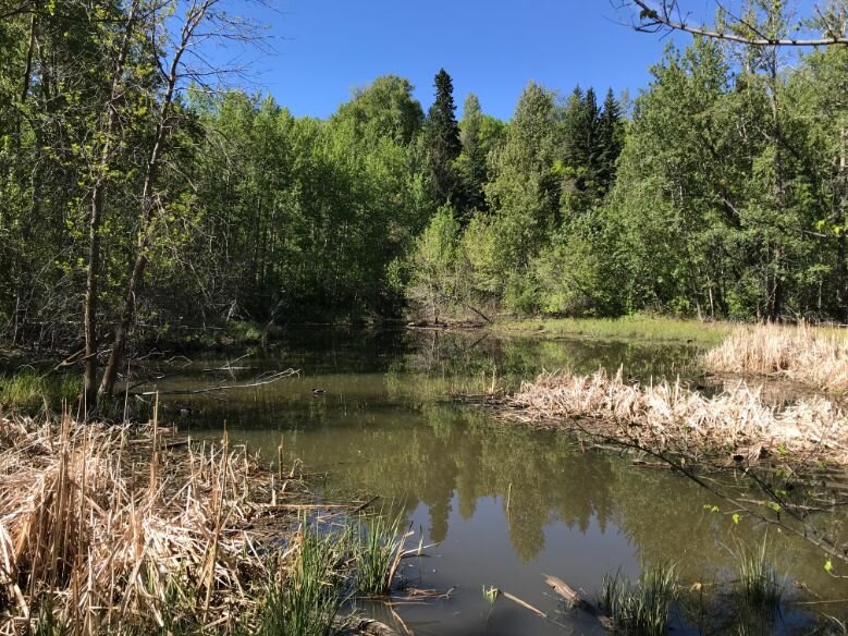
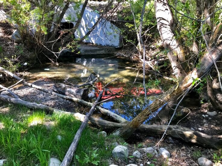
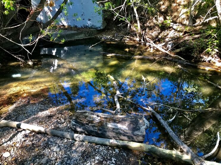
One of the things I love about this section of the Bow River Pathway are the small ponds you find when you wander off the main pathways. Sometimes the reflection of the sky and trees is like a Monet painting.

Lawrey Gardens
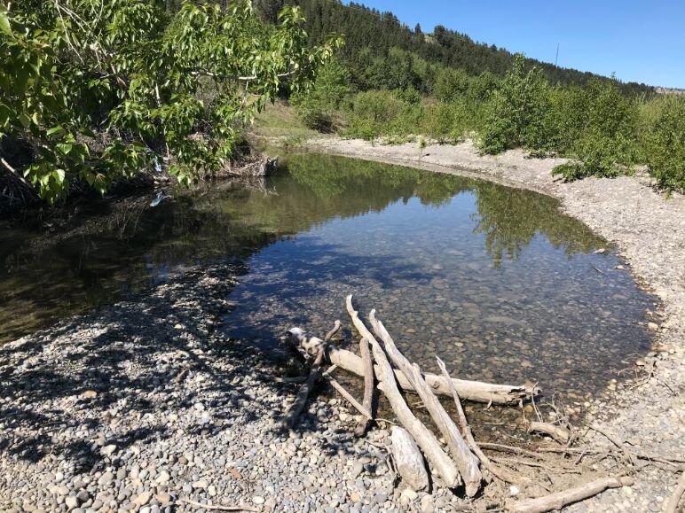
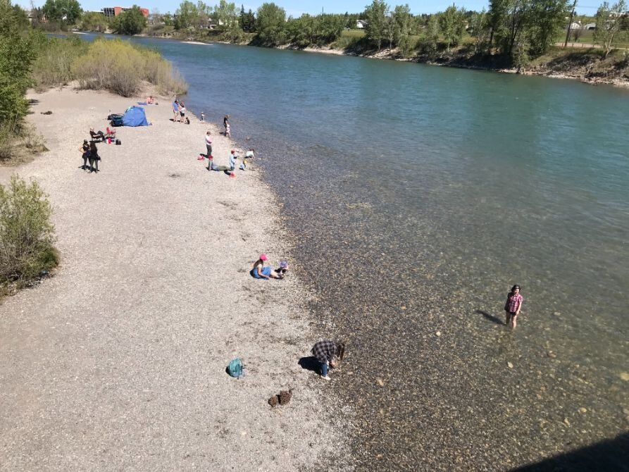
Calgarians, like most people around the world, have developed a greater appreciation for access to urban natural areas with the advent of COVID. Located just west and south of the Crowchild Trail Bridge, Lawrey Gardens is a hidden gem, and a rather unique one at that. It is not a manicured garden but a nature garden home to many native plants like the Round-leaved Orchid and Small Wood Anemone. It also includes a huge gravel beach that constantly shifts with the Bow River’s changing water flow - a great place to wander, just sit and reflect or rock hunt.
FYI: The area was once used as a landfill for demolished buildings including the iconic the remains of the Robin Hood Floor Mill that was part of the downtown skyline until 1973. You are literally walking on history. John Lawrey established one of Calgary’s first market gardens (hence the name) on this site in 1882, providing fresh fruit and vegetables to railway crews and early homesteaders.

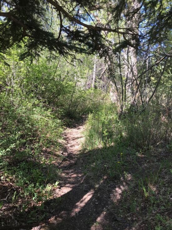
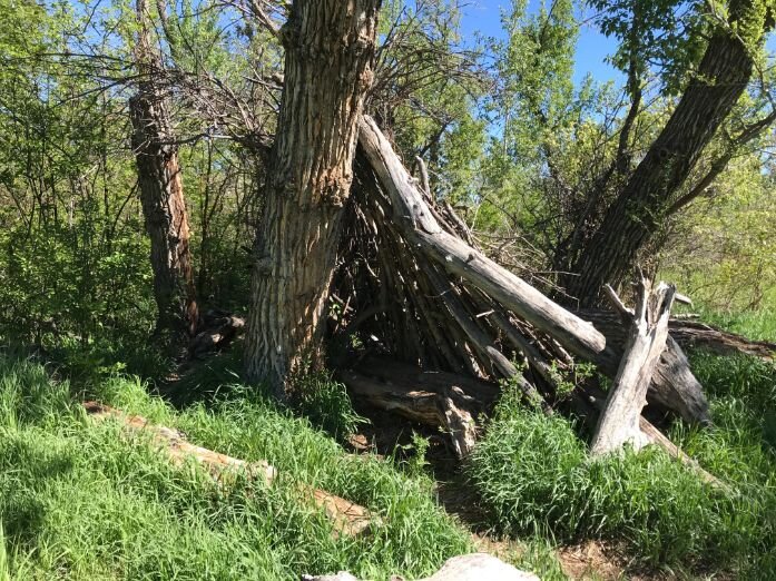
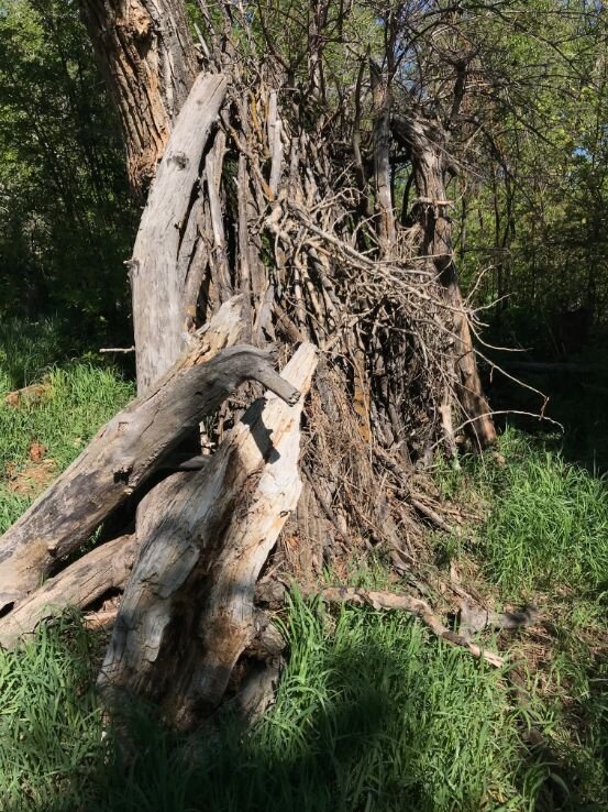
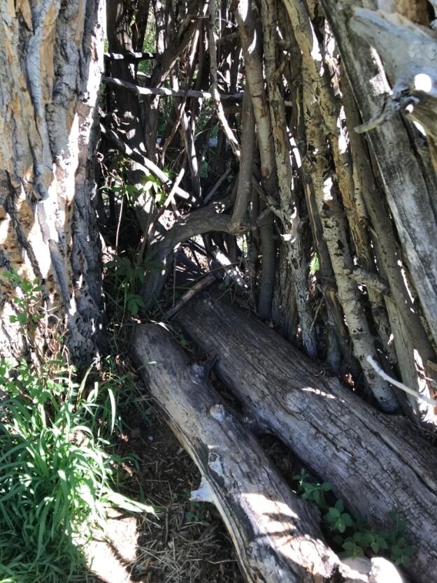
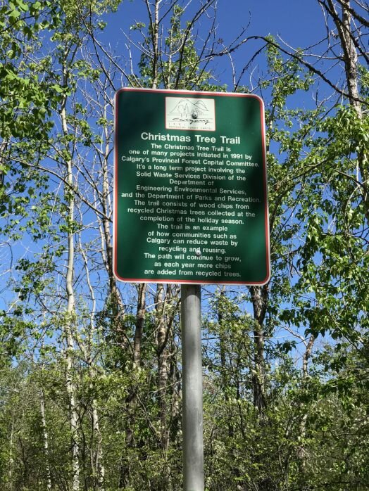
Off-The-Beaten Pathway
Numerous dirt trails meander off the established pathway allow you to easily become lost in nature. They lead to some lovely secluded ponds and meadows. You will even find some fun lean-tos that people have built. It is a great place to really get-away-from-it-all, or at least until a train comes rumbling by.
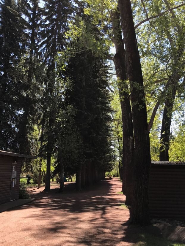
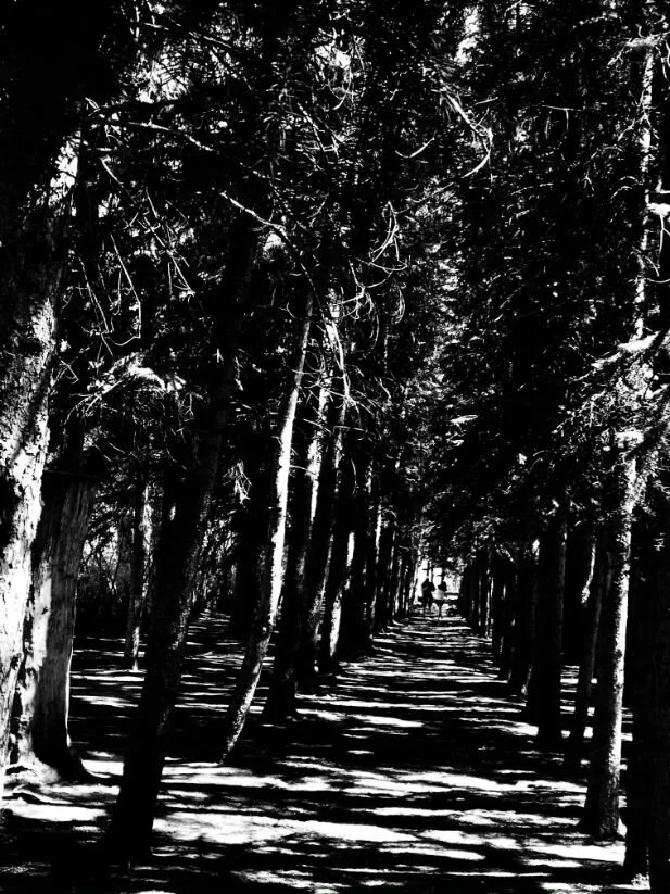
Douglas Fir Trail
This 2.5 km trail climbs the 200-foot high wooded steep escarpment on the south side of the Bow River. It has been nicknamed by some as “dead man’s drop” (for the dramatic drop from the top), while others refer to as the “drunken forest” (as many of the trees are growing at odd angles and the pathway is often wet with water from natural springs).
Some even refer to it as the “fake fir” trail, as Douglas Fir trees are not really fir trees, but their own genus. Whatever you call it, it is one of the most easterly stands of Douglas Fir trees in Canada. Some of the trees are over 500 years old and survive here only because of the abundant water and the protection from the drying winds. It is bit like a rain forest along the trail. It’s a “must-see – and do!”


Boothman Bridge / Edworthy Park
Thanks to Barry Lester, a regular Everyday Tourist reader, I have some inside information on this unique looking bridge, as it was built in the early ‘70s by the engineering firm of Simpson, Lester, Goodrich (Barry was one of the partners)..
Lester shared with me that “The challenge for pedestrian bridge designers in the ‘old’ days was to create an interesting landmark on a very tight budget. City administrators in those days were willing to consider interesting designs, but only if they cost no more than a bare bones solution. Our view was that crossing a bridge should be an "event" in itself, so we struggled to come up with solutions which would create identifiable landmarks without spending additional public dollars.”
“The Boothman bridge was designed in the '70's - the days of peace, love, and rock 'n roll. It was also the fledgling days of the back to the earth movement with geodesic domes and round bird's eye windows. The holes in the bridge reflect that movement. The principal designer was my partner Mike Simpson who, although an engineer, had strong ties to the environmental design movement (a founding partner of the Synergy West environmental consulting firm) and the Alpine Club of Canada.”
While Lester has no records of the costs of the Boothman bridge, he would hazard a guess at around $300,000.


Angel’s Cafe on the north side of the Boothman Bridge is a great place to stop for some refreshments and people watch.
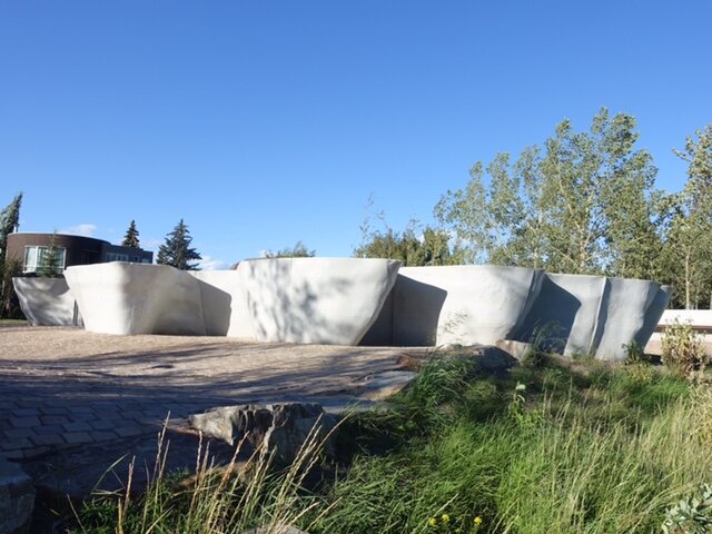
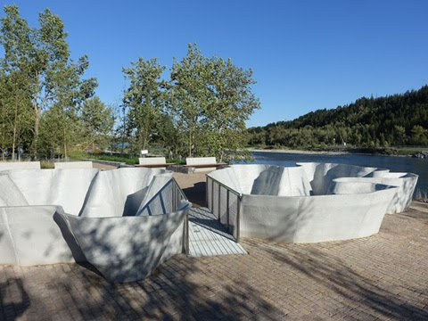
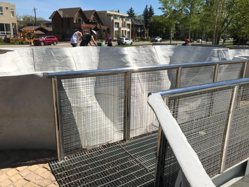
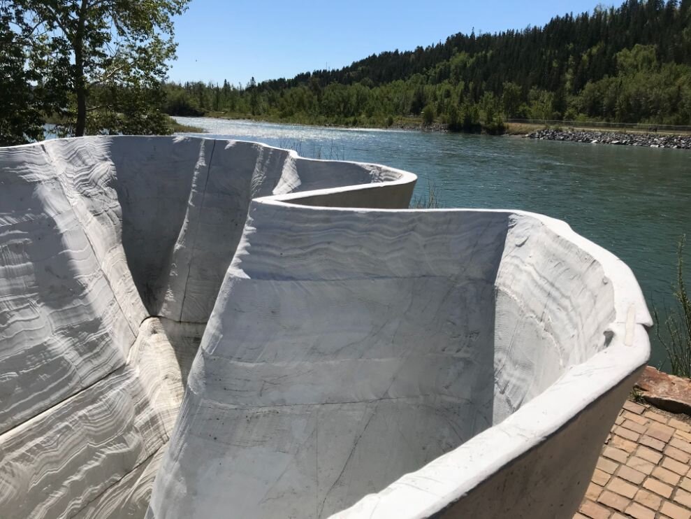
Parkdale Plaza
At the intersection of 34A St NW and Parkdale Boulevard sits a plaza dominated by a unique piece of public, “Outflow.” Designed by Brian Tolle, it is an inverted replica of Mount PeeChee, the third highest peak in the Fairholme Range just north of Canmore in the Bow River watershed. It is meant to memorializes the glacial origins of the Bow and how it has shaped our city over the years. For me, it looks more like the hoodoo rock formations in the Drumheller area.
Wherever I have visited there has never been any water flowing but it is designed so the public can watch storm water travel from the surrounding community through the inverted mountain to the Bow River via an outfall. It reminds us not only of the journey of the Bow River water across the prairies, but also of how our storm water flows underneath our city, eventually arriving at our rivers and creeks.
It is also a great spot to sit and people watch. It would be useful if there was some documentation at the site explaining the piece, as it isn’t obvious what it is and why it is there.
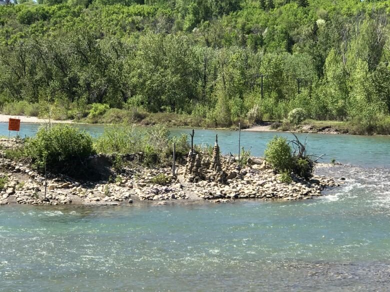
William’s / Archers’ Island
A substantial island just west of Crowchild Trail (24th Street) called William’s Island, was the location of the City’s water works infiltration plant in the early 20th century. Damaged in the flood of 1929, the plant was replaced by the Glenmore Reservoir in 1933.
The Island was then transferred to Calgary’s Parks Department and the old reservoir on the island used by the infiltration plant became a local swimming hole. The Calgary Archery Club also called the island home (hence, the nickname Archers’ Island).
In the mid-20th century, the island and surrounding Bow River at Crowchild Trail was used for gravel operations for various construction projects, resulting in the destruction of the swimming hole and some of the island.
Today, the island is a popular breeding site for ducks and geese, with no access by humans. It is also home to some amazing rock cairns at the west end of the island. I am tempted to wade over to the island this summer to check them out.

In this image you can see the three smaller islands that use to make up William’s or Archer’s Island. Perhaps even the large pebble beach was once part of the island as the gravel bars along the Bow River are constantly shifting.

William’s or Archers’ Island from the north shore of the Bow River.
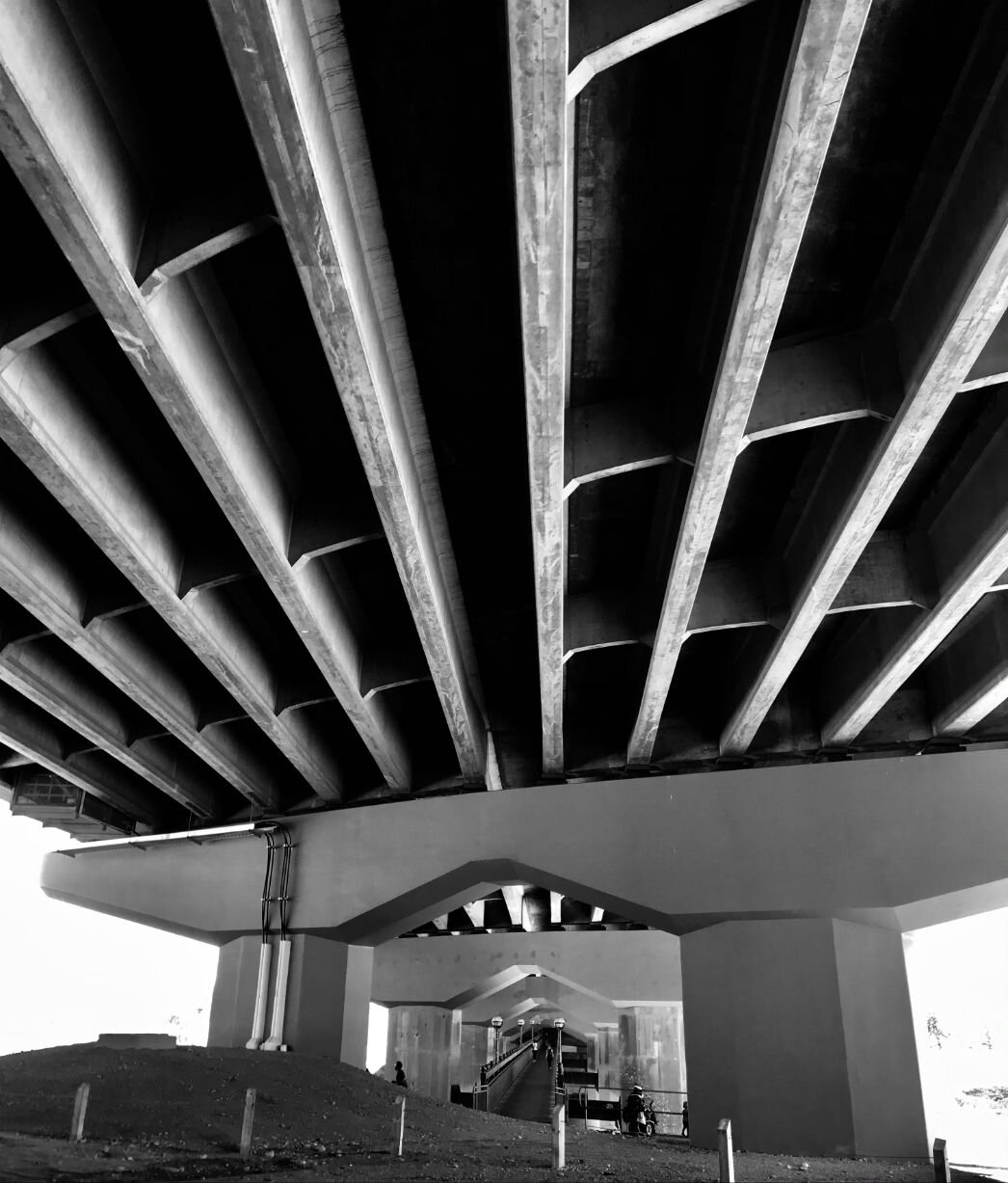
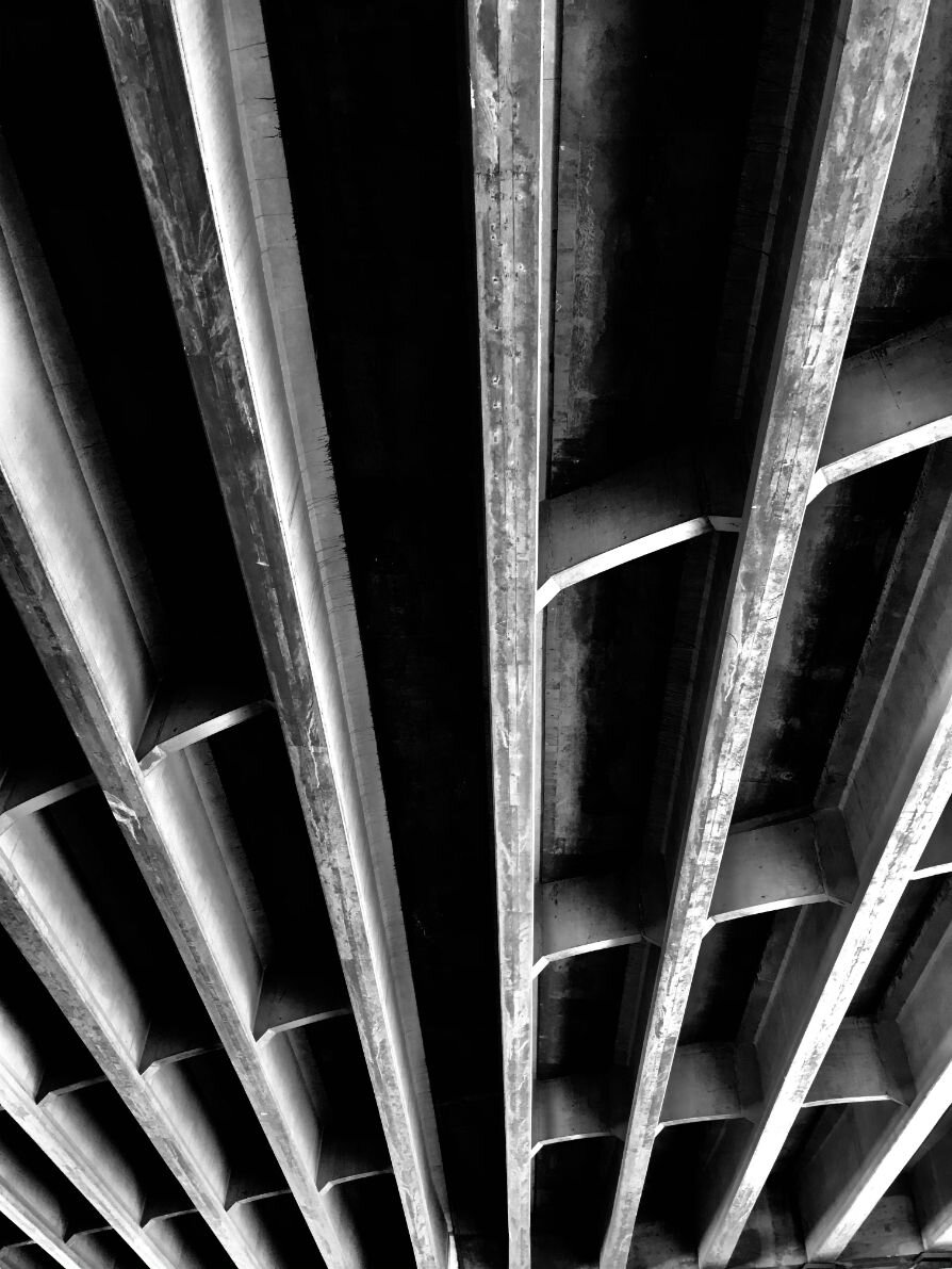
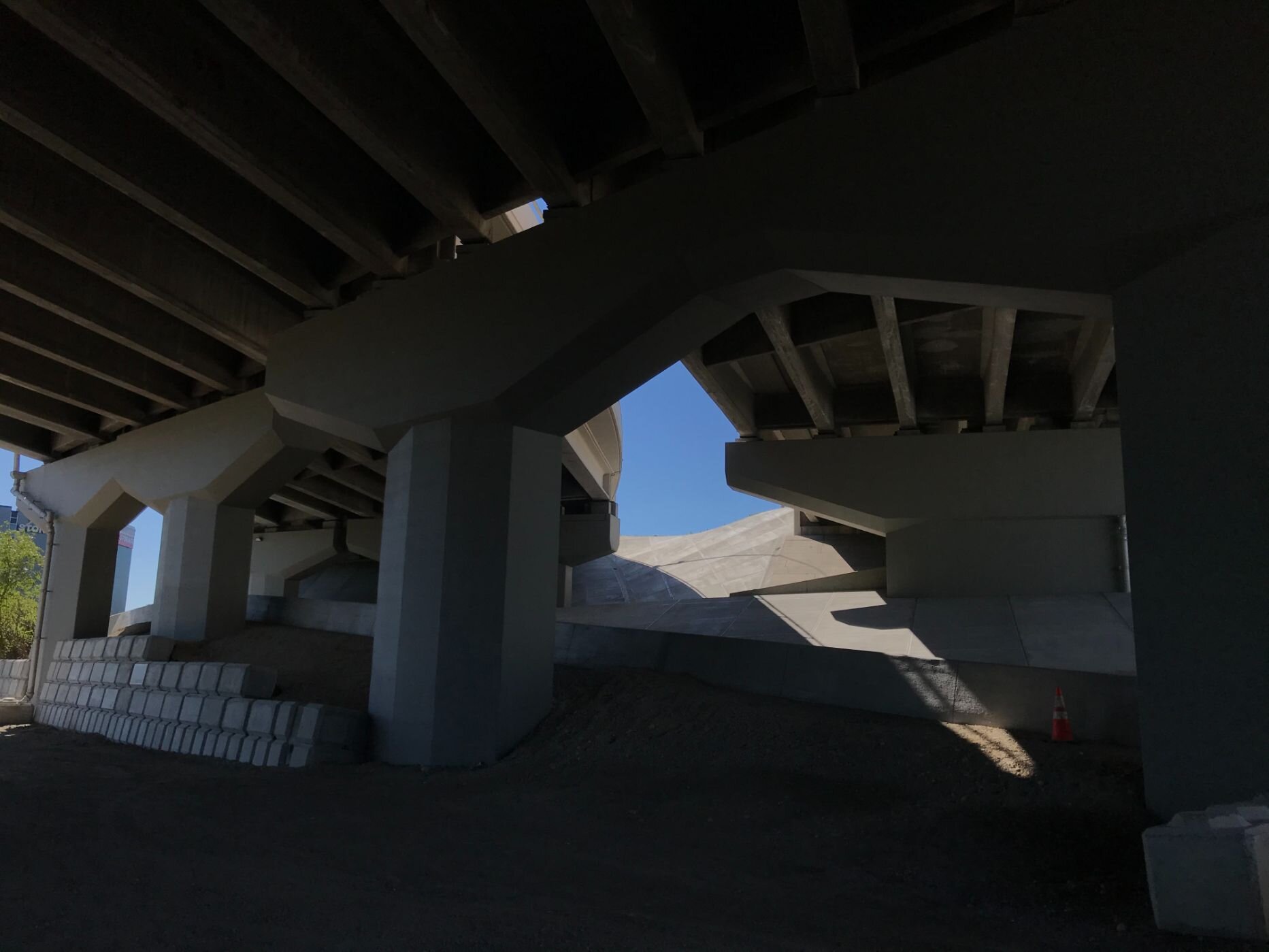
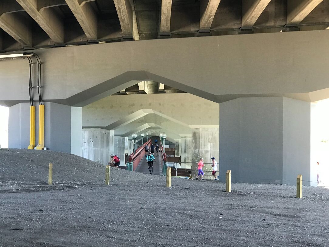
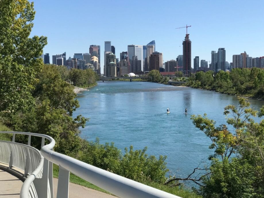
Dave Freeze Pedestrian Bridge
In the late ‘90s, the late Dave Freeze and I went for a walk from his home in Eau Claire to Edworthy Park and back several times. While walking, I casually said to Dave “if only there was a pedestrian bridge under the Crowchild Trail Bridge I could just cross the river here and go home rather than having to go all the way to 14th Street.” Only later did I find out Dave took this idea to his architect friend Bill Milne, who designed a pedestrian bridge utilizing the existing pillars of the Crowchild Trail bridge. It is my understanding Dave made a substantial donation to the Parks Foundation Calgary who worked with the City of Calgary and the Province to get all of the approvals needed and oversaw the bridge’s construction.
Today, it is popular bridge for cyclists and pedestrians alike and is a key part of Calgary’s Bow River pathway system.

It is a unique experience to walk under the Crowchild Bridge with the massive pillars and under-carriage of the bridge in full view.
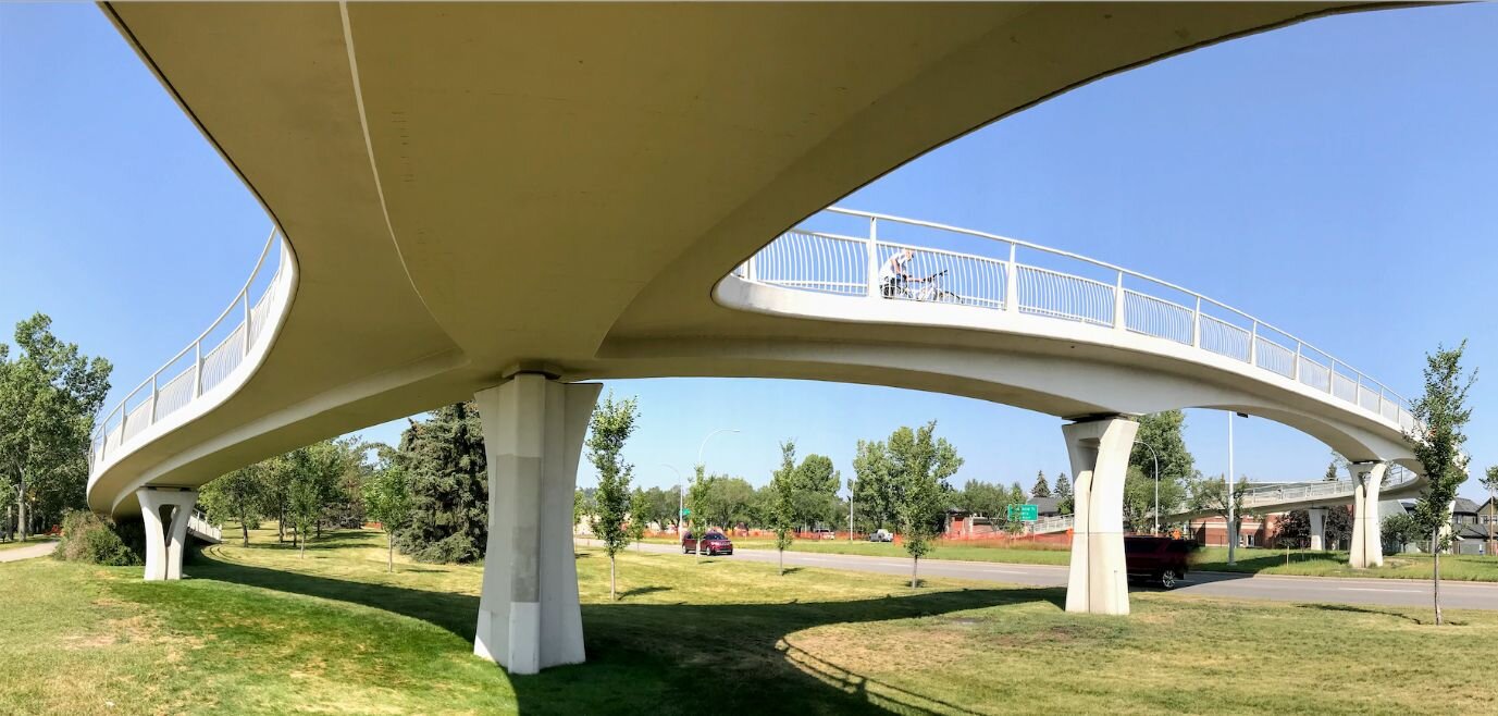
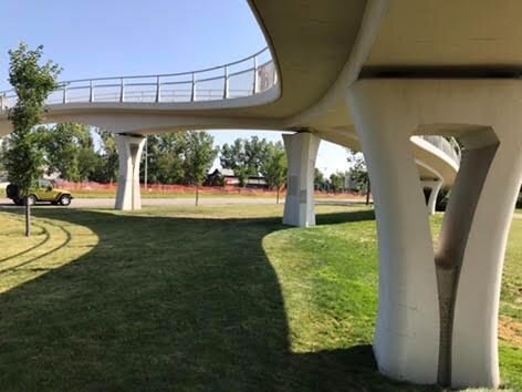
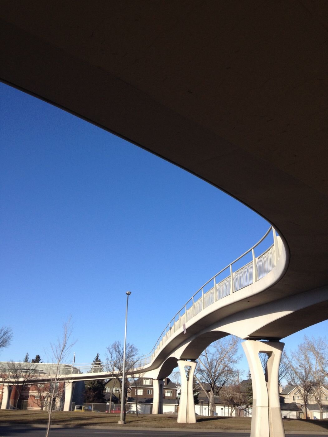
Bev Longstaff Bridge?
Since 2002, an elegant, curved, sleek, white no-name pedestrian bridge has connected the Bow River Pathway over Memorial Drive at 21st St NW where the old Boy Scouts Building used to be. (FYI. The City is investing $2.5 million to convert the building into the National accessArts Centre, where individuals with physical and developmental challenges can create art.)
In researching the history of this bridge, I learned there is a movement afoot to name it after long time City Councillor Bev Longstaff who championed the construction of this bridge to give the people living in West Hillhurst and Hillhurst better access to the Bow River.
This bridge was designed by City of Calgary engineer (clearly not every pedestrian bridge needs to be designed by a high profile international architect), Jadwiga Kroman. Insisting the bridge needed to be unique and not just a cookie-cutter pedestrian bridge, she definitely succeeded.
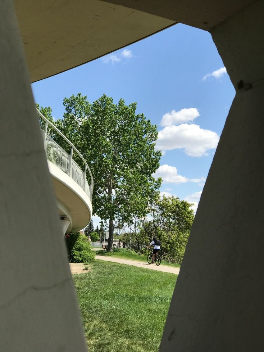
The bridge has three sweeping, sensual curved ramps that connect the bridge to the pathways on either side. It is elegant in its simplicity and has a spiritual, ghost-like presence that I find very attractive. I love to explore the pillars with their openings which create fun perspectives of the Bow River’s north shoreline. And, the bridge’s height over the Memorial Drive provides beautiful vistas of the Bow River and the downtown skyline.
For me, it is on par with Calgary’s two more famous pedestrian bridges - the Peace Bridge at Prince’s Island and the George C. King Bridge at St. Patrick’s Island.
Note: There is an opportunity to not only name the bridge after Councillor Longstaff, but to create a river park at the base of the bridge which already has a lovely grass and treed area and a pebble beach on the river. It could become the equivalent of the new $10.6 million West Eau Claire Park for residents of West Hillhurst and Hillhurst communities, at a fraction of the cost.

Last Word
This 8-kilometer tour of the Bow River pathway is just a small glimpse Calgary’s extensive public spaces across the city. With Calgarians having access to over 7,000 parks and green spaces and 1,000+ kilometers of pathways within the city’s limits. Calgary is indeed the “City of Parks & Pathways!”
DYK, all Calgarians live within a five minute walk of a green space or pathway.