PBS: Ten Parks That Changed America
Almost as soon as I started watching the PBS documentary (first aired in 2016) “Ten Parks That Changed America,” I thought “this would make an interesting blog,” so I started taking notes. Afterward, I thought, collectively these 10 parks would make for a great 10-year travel plan.
One thing I found interesting was that 200+ years ago, city leaders understood the importance of parks in fostering a healthy urban environment and in urban socialization (so not sure why urbanists today think these are new ideas). The documentary was also a reminder of how parks and cities have evolved over the past few centuries - how everything from toxic waste sites to abandoned rail lines can become popular “people places” if designed right. I even learned that parks can encourage people to hold hands!
Let’s start our trip across America from oldest to newest park...

Squares of Savannah (1733)

Chicago’s Millennium Park (2004)
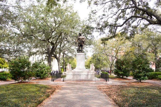
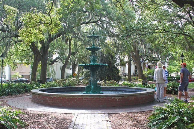
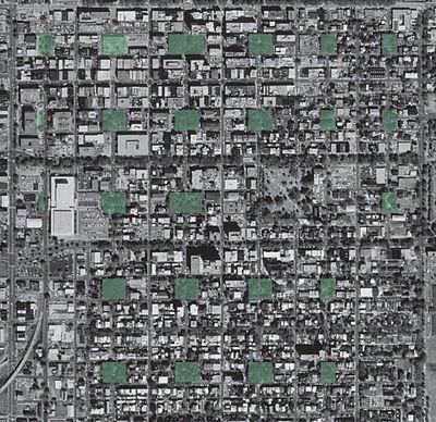
Squares of Savannah, Georgia (1733)

Each square is typically 200 feet north to south and 300 feet east to west.
In 1733, the city of Savannah’s streets were laid out by James Edward Oglethorpe in a grid pattern, with squares (parks) surrounded by four residential blocks and four civic (commercial) blocks. the eight blocks and park created a Ward.
By 1851, there were 24 public squares. However, three were destroyed in the 20th century, but one was reclaimed in 2010, bringing today’s total to 22.
The square parks quickly became the community gathering place as they not only provided shade from the summer heat and a place for families to play and picnic, but they also played a role in everyday life as each had a community water pump and ovens to bake bread.
Today the squares are used for public and private events year-round, including the St. Patrick's Day Parade in Oglethorpe Square.
It is interesting – given their popularity for almost 300 years - no contemporary replicas of the Savannah Squares have been created in other cities or even in Savannah’s suburbs.
Link: Squares of Savannah
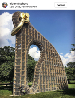
Fairmont Park, Philadelphia (1812)
In 1812, Philadelphia City Council purchased the land (that would eventually become Fairmount Park) for a new waterworks facility. The land was next to the Schuylkill River and contained a hill that was the highest point in the city, allowing for a gravity feed waterworks system. Development of the park began in the 1820s when gardens and walkways were laid out around the waterworks. The park was expanded in 1844 when the city purchased the nearby Lemon Hill estate. In 1873, 3,000 acres was added to the park to protect the river from private and industrial development. Today, the park is home to a large collection of public art (statues) dating back to 1872 and twenty historic homes. The 2,054 acres also includes an orchard, greenhouses, forested areas with walking trails, multiple playgrounds, baseball, soccer, basketball and disc golf facilities, was well as trails for hikers, bikers, runners and equestrian riders. The Philadelphia Museum of Art sits at one entrance to the park, overlooking a row of Victorian-era houses that have become architectural landmarks.
Fairmont Park was created to ensure citizens had a safe and reliable water supply, as well as the recognition 150 years ago by City leaders that urban parks were critical to health and wellbeing of its citizens.
Link: Fairmount Park


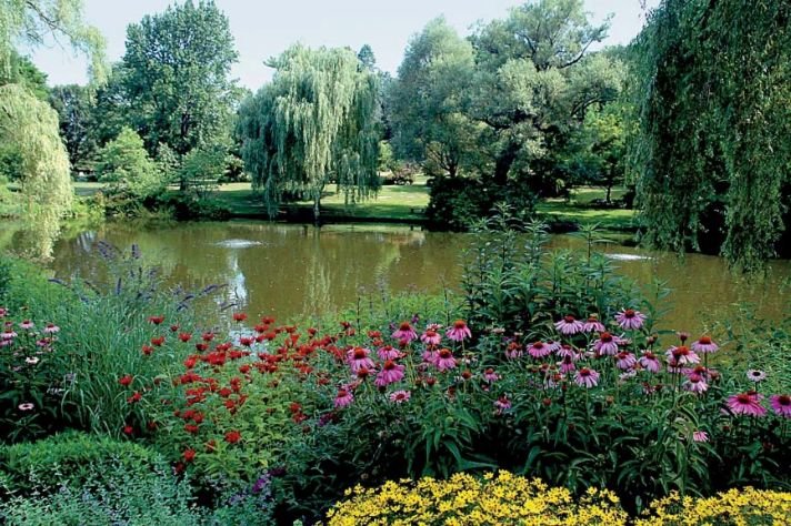
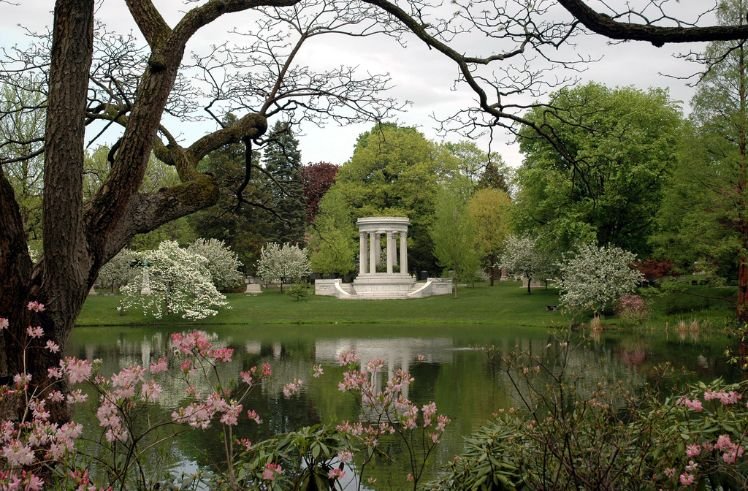
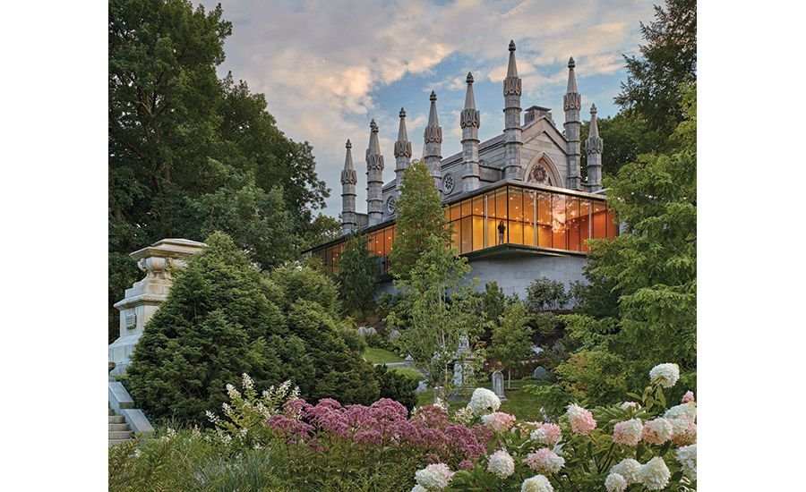
Mount Auburn Cemetery, Cambridge, Massachusetts (1891)
Mount Auburn Cemetery (1831), located between Cambridge and Waterdown, about 6-km west of Boston was the first rural garden cemetery in the United States. Prior to this, graveyards were unkept, unsafe and unhealthy plots of land most often next to churches. Jacob Bigelow, a local medical doctor, concerned about the unhealthiness of the church burials plots, suggested that land on the edge of the city would be more appropriate.
The PBS documentary traces Mount Auburn’s Cemetery’s curvilinear design and landscaping that replicated the gardens of English estates, (while another source indicates it was inspired by Pere Lachaise Cemetery in Paris). Regardless, this cemetery was the birthplace of the “cemetery as a park,” a place for the living and the dead. Some even think it is where landscape architecture began i.e., the integration of ponds, meadows and pathways to create a place where people can relax.
Link: Mount Auburn Cemetery


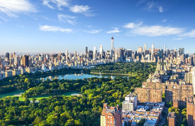
Central Park, New York City (1856)

New York City’s Central Park, is arguably the most famous urban park in the world is the masterpiece of the world’s most famous park designer – Fredrick Olmsted. In the early 19th century, New York City was populated mostly by new immigrants.
By the 1840s, city leaders recognized the need for a large public park to help integrate people from different cultures, as well as a place to relax and play.
In 1856, most of the park’s present land, ( a swamp at the time) was purchased for five million dollars.
Fredrick Olmsted and Calvert Vaux won the competition to design the park, which included not only the eviction of a village of African Americans and the movement of millions of cart loads of earth followed by the planting of five million trees and shrubs by the time it opened in 1876.
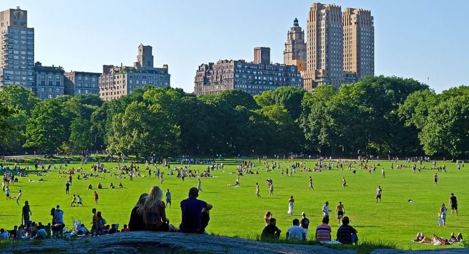
The park is designed to be a place for strolling, relaxing and calming in a city noted for its hustle and bustle and that “never sleeps.”
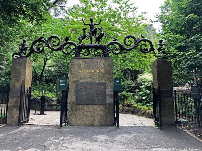
It includes a zoo, skating rink, three small lakes, open-air theatre, bandshell, many playing fields, children’s playgrounds, fountains and hundreds of monuments and plaques. The Metropolitan Museum of Art is in the park facing Fifth Avenue.
Central Park is a good example of the power of public parks in bringing people of all ages and backgrounds together and helping to eliminate class distinctions.
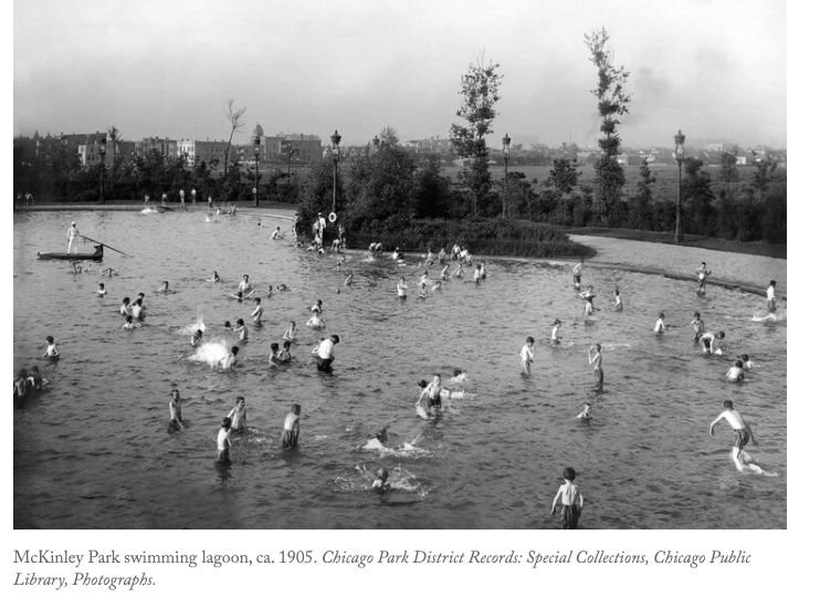
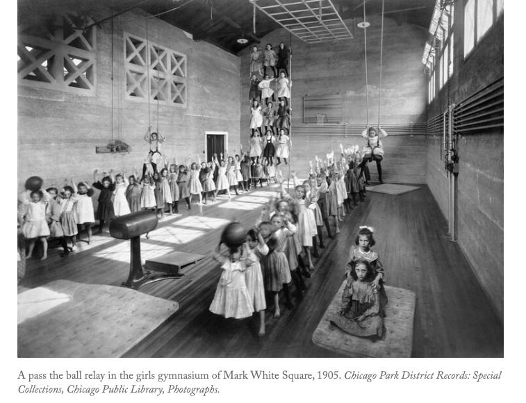
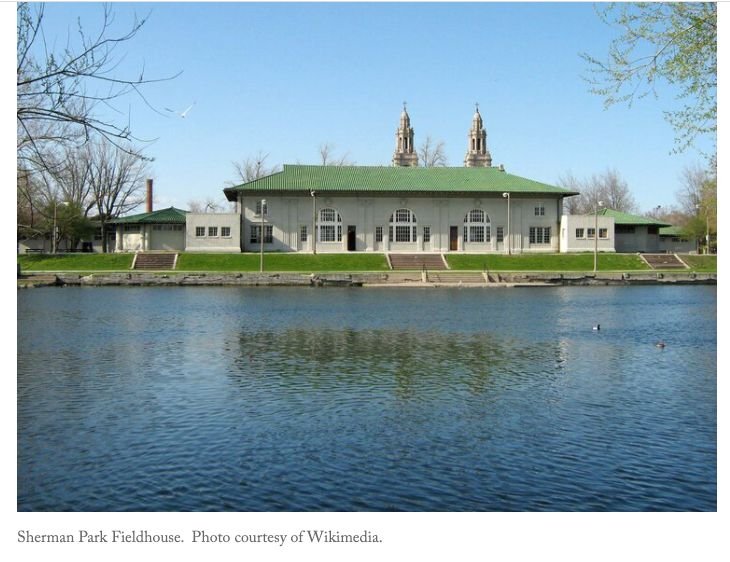
Chicago Neighborhood Parks (1891)
J. Frank Foster, who became the superintendent of Chicago’s South Park System in 1891, recognized the city’s existing parks were the pride of Chicago’s elite living near the lake, but also that there was a lack of parks to meet the needs of the city’s vast tenement districts.
With this latter group of citizens in mind, Foster had a much more progressive idea for what a public park could be. His vision was a system of smaller neighborhood parks to improve the lives of Chicago’s working class.
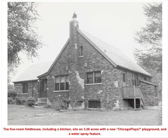
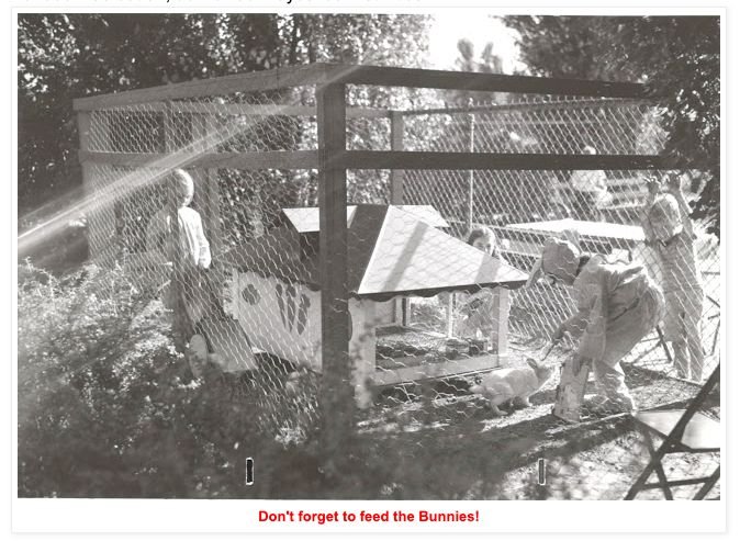
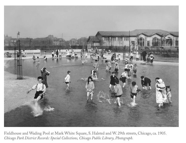
These innovative parks were more than just green spaces with playgrounds and swimming pools, but included Chicago’s first branch libraries, gymnasiums, ball fields, and "fieldhouses" offering a wide variety of programs and services. Today Chicago, is home to over 300 field houses or recreation centres.
FYI: Chicago’s early community parks were designed by Fredrick Law Olmsted’s sons – Fredrick Jr. and John Charles with the fieldhouses designed by Daniel Burnham.
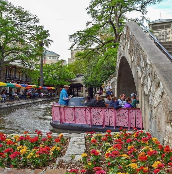
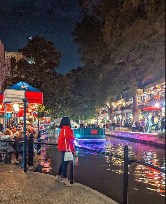
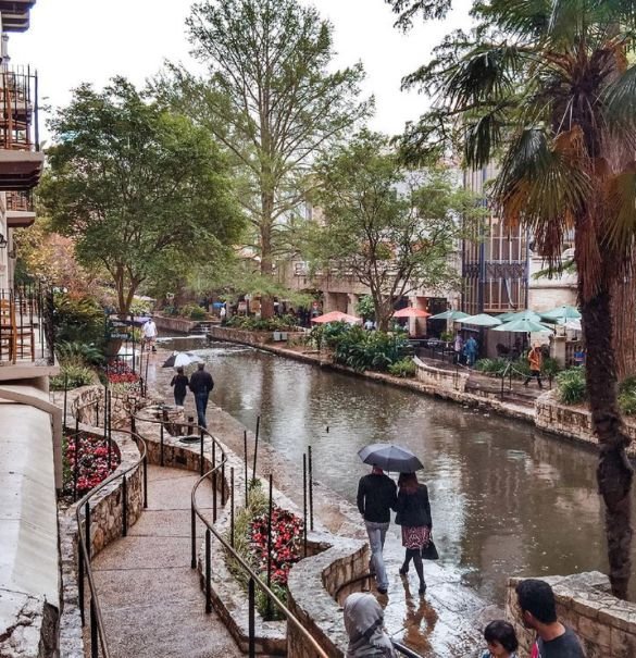
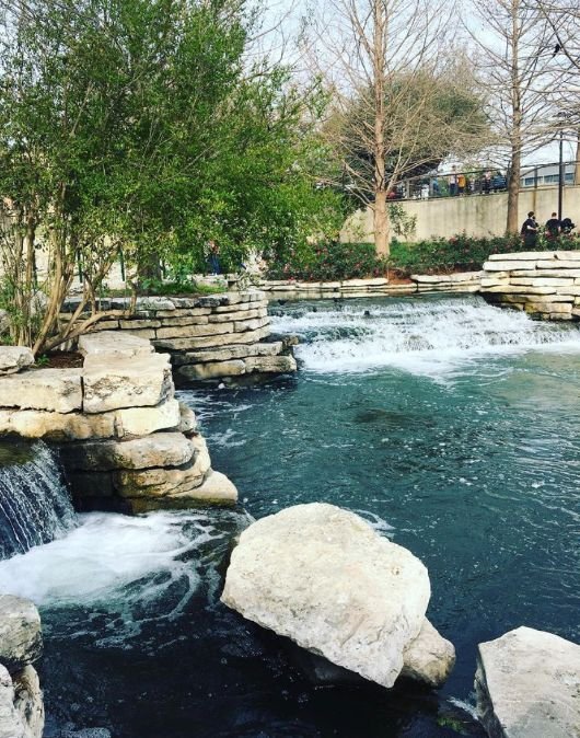
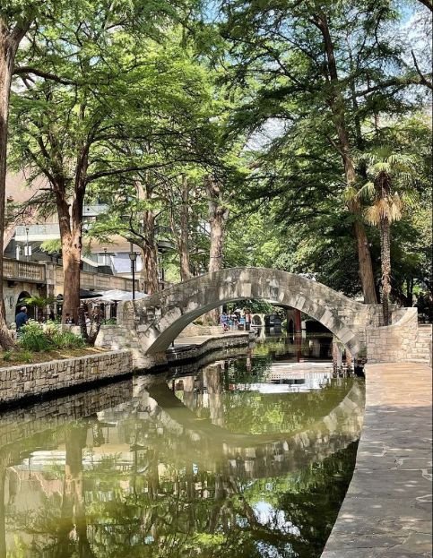
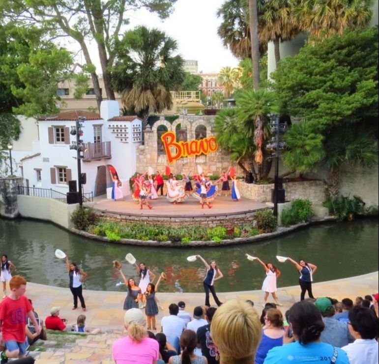
San Antonio Riverwalk (1946)
The devastating San Antonio River flood in 1921 was the catalyst for the city to build a dam upstream and create a storm sewer and bypass channel plan that would redirect the river from the downtown. However, the San Antonio Conservation Society successfully opposed the paved sewer and in 1929, San Antonio architect Robert Hugman submitted plans that would become the River Walk. Hugman’s noted the riverbank was lower than the downtown street, which sheltered the land just enough from winter winds to allow for a tropical garden walkway and the dammed upriver could accommodate Venetian-style gondolas. He envisioned a place where people could gather at cafes, restaurants and outdoor patios, gardens, and plazas year-round.
Though Hugman’s vision was initially not well received as the banks along the river were notorious for being dangerous, eventually he was able to convince the city and businesses along the river that his vision would work. Ironically the first restaurant to open onto the river was Casa Rio, next to Hugman’s office. While today new buildings have been built facing the river, originally existing business just added doorways at the back of their buildings to face the river.
Today, the River Walk stretches for 24 km and is home to numerous hotels, hundreds of restaurants and shops and several parades – Texas Cavaliers River Parade, Armed Forces River Parade, Ford Parade of Lanterns, Day of the Dead River Parade, Ford Holiday River Parade. It is one of the top 10 Tourist Attractions in the USA.

Overton Park, Memphis, (1906)
Originally known as Lea’s Woods, the land for Overton Park was purchased in 1901 by the City and landscape architect George Kessler was engaged to design the 342-acre park which opened in 1906. The park contains the Memphis Brooks Museum of Art, Memphis Zoo, a 9-hole golf course, the Memphis College of Art, Levitt Shell Theatre and the Old Forest Arboretum (a natural arboretum with labeled trees along trails).
In 1957, a six-lane freeway was proposed through the park as a means of revitalizing Memphis’ downtown by improving its accessibility from suburban neighbourhoods. Construction of the freeway started even though Sally Hines (a community minded citizen) and other community leaders had initiated the “Citizens to Preserve Overton Park” campaign which ultimately led to a United States Supreme Court ruling in favour of the preservation of the park. This decision set a precedent for saving parks across the USA.


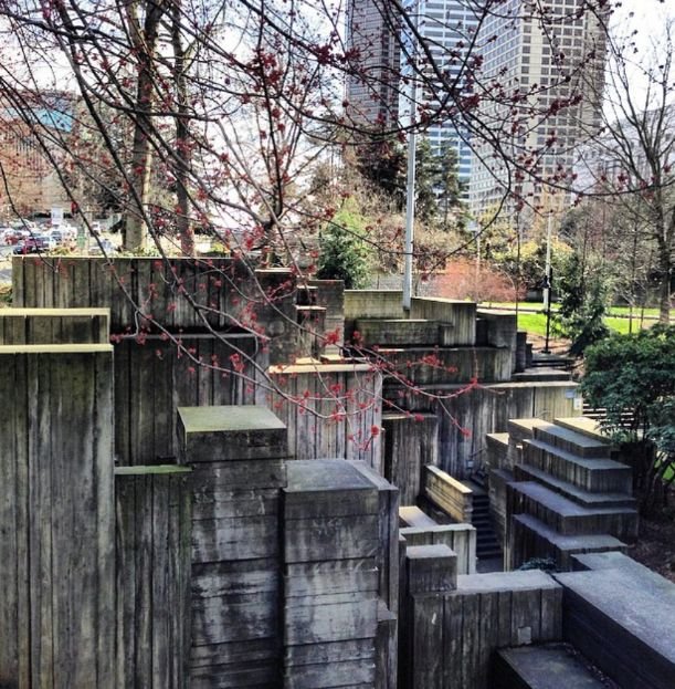
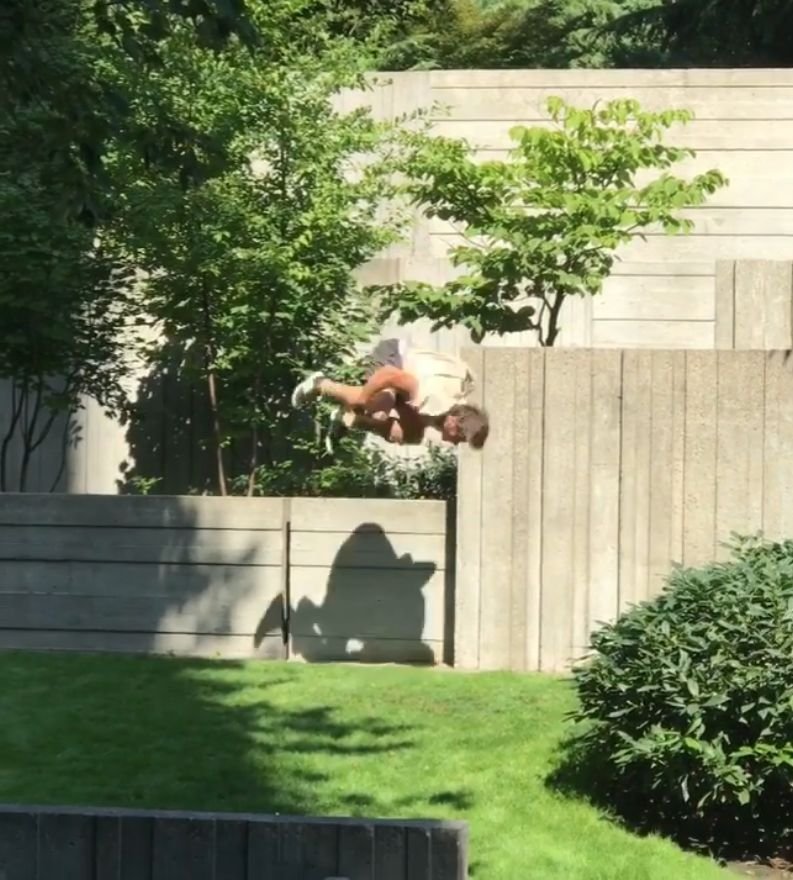
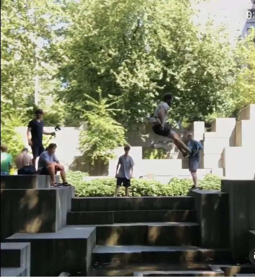
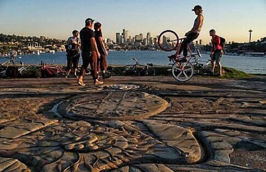
Freeway Park, Seattle (1976)
In 1966, the Interstate 5 freeway brutally cut Seattle’s city centre in half, isolating the downtown from its residential neighborhoods on the east side of the freeway. Then, In the early ‘70s, the city envisioned an urban park on top of the freeway and a city-owned parking lot, as a means of connecting the downtown to the adjacent First Hill neighbourhood. The 5-acre park designed by Lawrence Halprin opened in 1976 with an addition to the park in 1982.
This unique brutalist park is a series of irregular shaped plazas intertwined and enclosed by concrete planters, walls, fountains and waterfalls. The park was added to the National Register of Historic Places in 2019. It is also considered to be one of the top 10 places in the world to “parkour” (the extreme sport of running, crawling, jumping, and hurling yourself freely over obstacles to get from one point to the next in the fastest way possible).


Gas Works Park, Seattle, 1975
Imagine turning a toxic waste site into a park – that’s what Gas Works Park is. In 1956, the Seattle Gas Light Company closed its plant on the shore of Lake Union, leaving the land covered in 9 to 14 feet deep of black sludge and a ghostly metal skeleton of the gasification plant that had operated since 1906.
In 1962, the City of Seattle purchased the site for a park and engaged Richard Haag to design it. Haag lived on the site for to get a better appreciation of the site’s unique opportunities, and instead of removing the old industrial plant, he recommended preserving it as a reminder of the city’s industrial past. He also recommended bio-phyto-remediation of the soil, thus allowing for the sludge to be reclaimed.
Today, the park is entered through a landscaped parking area or through the Burke-Gilman Trail, a bike and walking path that connects Puget Sound to Lake Washington. Dividing the parking area from the park is a grassy berm and rows of trees demarcating the old railroad right of way. The park is composed of seven areas: Earth Mound, North Lawn, Towers, Prow, Picnic Lawn and Shelter, Play Barn, and South Lawn. The Earth Mound, Prow, and Lawns are three open areas intended for passive and active recreation and offer magnificent views. The Towers, Play Barn, and Picnic Shelter incorporate elements of the original manufacturing structures.
Link: Gas Works Park


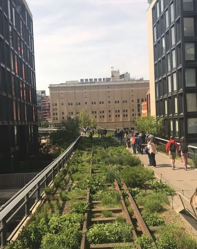
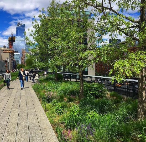
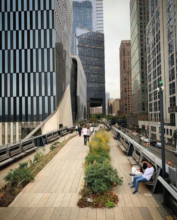
High Line, New York City (2014)
The story of the NYC’s High Line would make for a good movie. A couple of enlightened citizens had the crazy idea that you could transform an abandoned, elevated freight train line from a garbage dump into an urban oasis. Yes, in the late ‘90s, Joshua David and Robert Hammond founded the “Friends of the High Line,” a non-profit conservancy to advocate for the preservation and reuse of the High Line owned by CSX Transportation.
In 2003, an international ideas competition was held. The result: 720 ideas for repurposing the tracks from 36 different countries – everything from a rollercoaster to a mile-long lap pool.
In 2005, CSX Transportation donated the elevated rail structure to the City of New York and landscape architecture firm James Corner Field Operations; design studio Diller Scofidio + Renfro; and planting designer Piet Oudolf were the team chosen to transform the High Line, the next year - with Richardo Scofidio as the project’s leader.
Like Richard Haag and the Gas Works site, Scofidio, David and Hammond wanted to preserve the uniqueness of the site, integrating the ruins of the old railway, with existing wildflowers and new plants and materials to celebrate the urban environment.
The High Line, from 30th and 34th Streets and 10th and 12th Avenues opened to rave reviews in 2014. Five years later, the Spur opened at 30th Street and 10th Avenue, creating a 3-km long greenway featuring 500+ species of plants and trees. It is now home to numerous gardens, artworks, programs and performances.
Joshua David and Robert Hammond are delighted with how the High Line has successfully encouraged New Yorkers (known for their fast walking), to slow down, stroll, sit and people-watching. One of things David and Hammond love best about the park is that they have observed there is significantly more handholding along the High Line than anywhere else in the city.


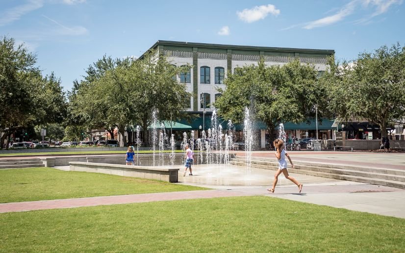
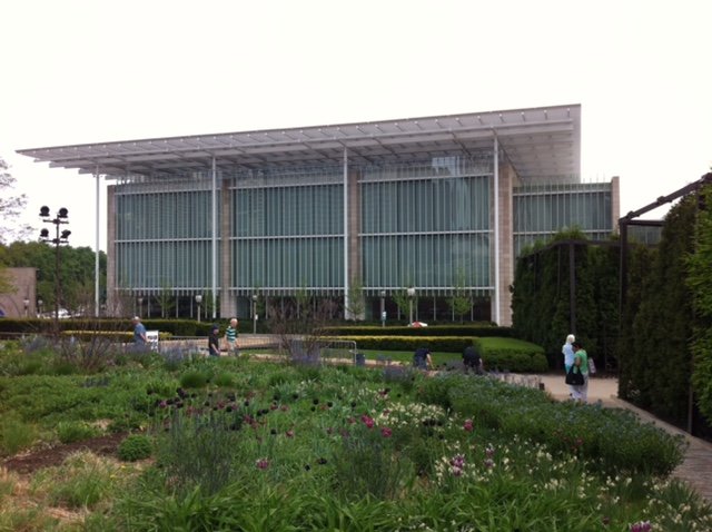
Millennium Park, Chicago (2004)
I can’t believe the producers of the documentary didn’t include Chicago’s Millennium Park, the 25- acre park conceived in 1997 - and opened in 2004 - to celebrate the third millennium. This contemporary urban park has two of the world’s most popular interactive pieces of public art – Cloud Gate (aka The Bean) by Anish Kapoor and Crown Fountain (operates May to October) by Jaume Plensa.
It also includes:

Jay Pritzker Pavilion (a bandshell designed by Frank Gehry) and Lurie Garden.
BP Pedestrian Bridge (also by Gehry) connects the park to other parts of the huge Grant Park.
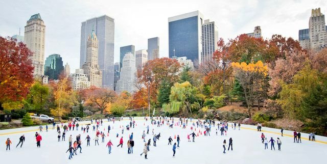
McCormick Tribune Plaza & Ice Rink & Grill is a multipurpose venue, ensuring the park has year-round activities. In the winter it attracts 100,000+ skaters; in the summer, it becomes an al fresco dining facility.
Harris Theater is a 1525-seat theatre for the performing arts, while Wrigley Square on the northwest edge of the park contains the Millennium Monument, a nearly full-size replica of the semicircle of paired Greek Doric-style columns, as well as a large lawn and fountain.
McDonalds’ Cycle Centre is a 300-space heated and air-conditioned indoor bike station.
Exelon Pavilions are four solar energy generating structures – three serve as entrances to the underground parking garage (3,800 stalls) with the NW one being the park’s Welcome Center.
Boeing Galleries is a pair of outdoor exhibition spaces that host grand-scale art exhibitions in the summer.
Chase Promenade is an open-air tree-lined pedestrian walkway that also accommodates exhibitions, festivals, and other events.
Nichols Bridgeway that connects the south end of the park with the Modern Wing of the Art Institute of Chicago, meets all the requirements for universal accessibility.
The park is also unique in that it sits atop a parking garage and commuter rail station, making it the world’s largest rooftop garden. Today, it is Chicago’s second most popular tourist attraction and home to the city’s annual Christmas tree lighting.
FYI: The cost of the park was an astronomical $500 million. I visited the park in 2013 and was totally gobsmacked by how it attracted so many people of all ages and backgrounds. Calgary has spent $500+ million over the past 25+ years trying to improve its downtown’s parks, plazas, and cultural spaces and achieved nothing that compares to Millennium Park in attracting locals and tourists to visit.


![photo[1].jpg](https://images.squarespace-cdn.com/content/v1/50e1b9c6e4b015296ce398f6/1647888122174-W81EM6FYGNTQMDVWEM10/photo%5B1%5D.jpg)


![photo[2].jpg](https://images.squarespace-cdn.com/content/v1/50e1b9c6e4b015296ce398f6/1647888160991-P3DMQVRL995LW3KI4WM8/photo%5B2%5D.jpg)


Last Word
I am now thinking I should research what are the “10 Parks That Changed Canada” or maybe the “10 Parks That Changed Calgary.” Stay tuned….
If you like this blog you will like these links:
Parks: A must for urban living?
A Walk In The Park: Stanley & Nose Hill
Calgary puts the PARK in PARKades!