Things to do in Calgary: Parks, Pathways & Playgrounds
Calgary’s amazing collection of parks and pathways have been put to a test during the COVID pandemic. Calgary is fortunate that early settlers, championed the idea of transforming the treeless barren prairie next to two rivers, into a beautiful park-like city. Calgary’s moniker could easily be “The City of Parks, Pathways & Playgrounds.”

Calgary is home to two of the largest urban parks in North America. Above is Nose Hill Park that encompasses 11+ sq km. It is just 9 km north of downtown. (photo credit: Peak Aerials)

This is just the western part of Fish Creek Park, it stretches 19 km from east to west with a total area of 13+ sq km. It is 21 km south of downtown. It offers 100+ km of paved and unpaved pathways. (photo credit: Peak Aerials)
The Early Champions
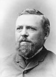
William Pearce
Calgary’s park history dates back to the late 1880s when William Pearce convinced the city to set aside a 200 foot wide land reserve on the north side of the Bow River from the Langevin to Louise Bridge.
Today that land is Memorial Drive and the very popular Bow River pathway. It is so busy the City has closed off one lane of the road on weeks to allow for more room for pedestrians and cyclists.
Back in 1885, the land we now call Shaw Millennium Park was set aside to become a park space – eventually it became the Mewata Armories and Mewata Stadium.
In 1890, the City got title from the Federal government to three Bow River Islands and named them – St. George’s (Calgary Zoo), St. Andrew’s and St. Patrick’s. (Note: Following a drowning in 1920, the lagoon and swimming pool between St. Andrew and St. George’s Islands was filled in to create a larger St. George’s Island.)
In 1889, the CPR developed their Station Garden next to the railway station on 9th Avenue where the Calgary Tower now stands. At the same time the CPR was also accumulating a substantial debt to the City for unpaid taxes which resulted in the City getting the land that would become the Central (Memorial) Park 20 years later.
In 1908 the Calgary Horticultural Society was formed and immediately began champion the idea of planting more trees and creating more parks. In 1909, the City of Calgary struck the Parks Board to oversee the development and management of city parks.

William Reader
1910 was an important year as Ezra Hounsfield Riley donated 20 acres to the City which was to become Riley Park and James Shouldice donated 100 acres along the Bow River with the condition it must be used for recreational purposes; this became Shouldice Park.
But perhaps the most important decision in Calgary’s parks and pathway history was in 1913 when the city appointed William Reader (personal gardener for Pat Burns) as the City’s Park Superintendent.
He served in this role until he retired in 1942. By then he had converted Calgary from a frontier city on the barren prairie, into a city with some of the best parks, boulevards and pathways in Canada including the Reader Rock garden.
Today
Over the past 100+ years, Calgary has not only been served by the efforts of the Calgary Parks but the formation of the Parks Foundation Calgary, which over the past 30+ years has raised $200+ million for the development of park and pathways projects, as well as $2.5 million in community playgrounds and green spaces and 1,200 dedicated benches and picnic tables. The Foundation’s signature project is the 138 km Rotary/Mattamy Greenway that encircles the city connecting almost half of our city’s population.
In addition, Calgary developers have continued the tradition of Erza Riley and James Shouldice in working with the City to create new pathways and parks as part of new master-planned suburbs.
The City of Calgary provides:
8,000 hectares of parkland and natural areas
905 km of multi-use pathways
20 km of indoor elevated pathway
1,100 playgrounds (this doesn’t include school and new community playgrounds)
475 soccer fields and 430 baseball diamonds
8,400 park benches (this doesn’t include 1,000s of none City benches)
Note: An edited version of this blog was published by Live Wire, on June 1, 2020. If you would like to see some amazing aerial photography of Canadian cities checkout Peak Aerials

Last Word
Even though Calgary has one of the largest parks/pathways systems in Canada and every Calgarian lives within five minutes of a green space, it was still difficult for everyone to social distance. As our city continues to evolve in the 21st century, we will need to continue to look for ways to provide more parks and pathways that everyone can enjoy.
If you like this blog, you will like these links:
A Walk In The Park: Stanley vs Nose Hill