Calgary Hidden Gems: 15 Parks and Green Spaces
Richard White (a.k.a. Everyday Tourist) recently wrote an interesting blog about eleven parks that have shaped or changed Calgary. Richard later sent me an email asking if I would be interested in writing a blog about Calgary Parks that might be considered Hidden Gems.
Calgary has a great variety of parks, green spaces and environmental reserves. This includes ponds and wetlands, coulees and ravines, escarpments and bluffs, historic parks, gardens and ornamental parks, paths and trails beside rivers and creeks and paths in many communities. The City of Calgary Parks website lists almost eighty parks that have been divided into five groupings of downtown and each of the four quadrants of the city. In compiling this list of hidden gems, I selected three downtown parks and green spaces and three from each of the four quadrants.
Guest Blog by David Peyto
(Peyto is on a quest to walk every street in Calgary. Currently has walked about 70% of the city’s streets, avenues, boulevards etc. or about 5,000 kilometres, wearing out four pairs of shoes in the process. He is currently focused on completing a set books that will outline several of long distance walks in Calgary, in recognition of 2025 being the 150 anniversary of the establishment of Fort Calgary. The first of these books The Chickadee Way: Griffith Woods to Zoo Station was published in the fall of 2019. The 205 km walk is divided into 19 sections. Thirteen of the sections connect to CTrain Stations and two of the sections are loop walks, making for a fun series of walks. The books are full of fun facts and history of Calgary.


Downtown Hidden Parks and Green Spaces
The three choices for hidden gems in the downtown area are in the communities of Sunalta, Scarboro and Bankview. These three parks were enlarged or developed by closing roads. For a walking tour of the three parks start in Royal Sunalta Park at the intersection of 14th Avenue and 17th Street SW. This park adjacent to Scarboro Community Hall and the Calgary Tennis Club was enlarged when parts of Sudbury Avenue and Sharon Avenue were closed.
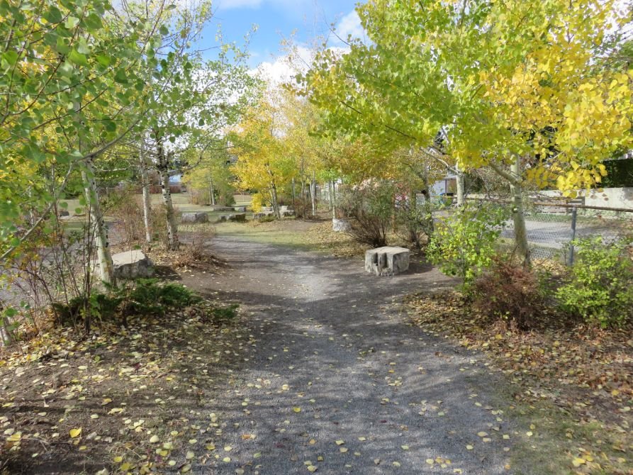
From the park head south into Bankview to Nimmons Park at the intersection of 17th Street and 19thAvenue SW. This park was created by closing 19th Avenue between 17th Street and 17A Street. The Nimmons family settled in the area that is now Bankview and Knob Hill in 1884. Sculptures by Katie Ohe are located in the park.
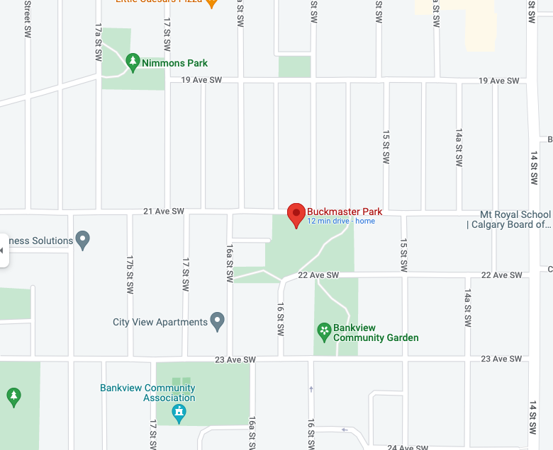
From Nimmons Park continue to Buckmaster Park at the intersection of 21st Avenue and 16th Street. This park was created when portions of 16th Street and 22nd Avenue were closed. The park is named in recognition of the volunteer work of Bankview residents Harvey and Margaret Buckmaster.

Royal Sunalta Park


Bankview: Nimmons Park

Bankview: Buckmaster Park
Northwest Hidden Parks and Green Spaces
Some of the school grounds in the city have natural areas that were created by students, parents and staff of the schools. The first northwest choice is the natural area at Banff Trail School. The natural area is a short distance from the playground beside the school field’s north fence. The features include a seating area, trails, a mixture of vegetation and information boards. The school field is at the west end of West Confederation Park formerly known as Canmore Park and North Capitol Hill Park.
The second northwest hidden gem is the Kincora coulees. Some of Calgary’s new communities have been designed with an entry road into the community leading to a t-intersection with a park or green space on the far side of the intersection. Follow Kincora Boulevard from Symons Valley Road to the t-intersection with Kincora Drive. On the west side of the intersection a path leads into a coulee. The coulee soon splits in two. Choose one of the coulees and follow the path through the coulee to Kincora Drive. From there walk along Kincora Drive to the second coulee. Return to your starting point through the second coulee. There is a third coulee on Kincora Glen Green which is on the route of the Rotary/Mattamy Greenway.
The third northwest choice is Panorama Hills coulee and ponds. A good starting point for a walk is on Panatella Boulevard just west of Panatella Close. From there follow the coulee south or north. From the same starting point a path can be followed around two ponds. At the west end of the second pond there is the option of walking a short distance along Panamount Hill to view the natural area at Buffalo Rubbing Stone School.
Banff Trail School Park


Kincora coulees


Panorama Hills pond

Northeast Hidden Parks and Green Spaces
The first northeast location is Country Hills Village Pond north of Country Hills Town Centre. A path leads around the pond. Vivo for Healthier Generations is adjacent to the northwest corner of the pond. On the east side of the pond a path leads to Calgary’s only lighthouse.
The second northeast choice is Saddle Ridge Wetlands. A path and a trail lead around the edge of this wetlands. Hugh Bennett Park on Saddlecreek Way is at the south end of the park. The park is dedicated to the memory of Hugh Bennett who moved to this area with his family in 1929. In 1968 Hugh became the first president of the Saddle Ridge Community Association. John Lewis settled in this area in 1889.
The third northeast choice is the Properties Pathway which makes a loop through the communities of Whitehorn, Temple, Pineridge and Rundle. This path is a great family bike riding route as there are almost 15 schools along or near the route allowing the opportunity for playground breaks.
(need a map or better directions)
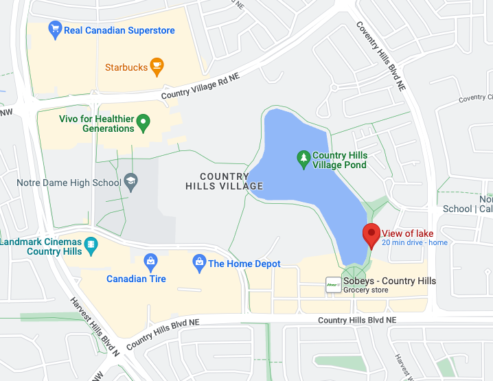

Country Hills Village Lake

Saddleridge Wetlands

Saddleridge Wetlands

Properties Pathway

Whitehorn, Temple, Pineridge and Rundle Pathway Circle
Southwest Hidden Parks and Green Spaces
The first choice in the southwest is Somerset Square. This park is at the t-intersection of Somerset Gate and Somerset Drive. The park has flower gardens, two sculptures, tennis courts, basketball hoops, a childrens’ spray park and a washroom/change building. The park has an arch at the entrance and a gazebo-like structure. On both the arch and the gazebo pillars are gargoyle-like decorations with a water-related theme.
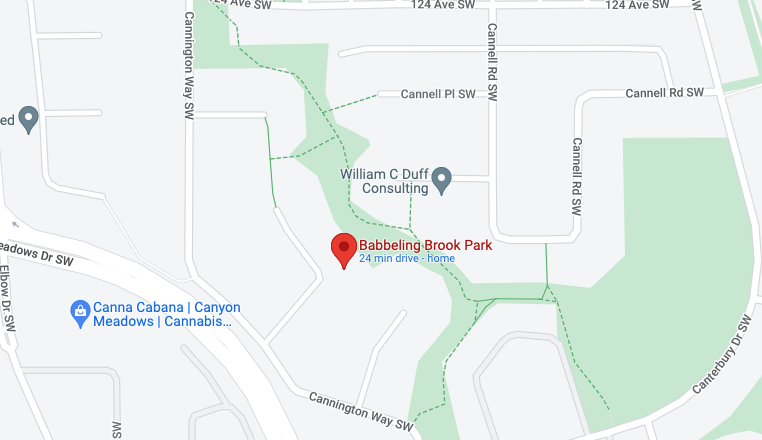
Babbling Brook Park in Canyon Meadows is the second southwest choice. The south end of this park is adjacent to the intersection of Canterbury Drive and Cannington Way. From this lower end of the park where a small stream goes underground a trail can be followed across several small bridges to the upper north end of the park. The water comes to the surface in an ornamental fountain and then trickles down to the south end of the park.
Valour Park in Currie is the third southwest choice. The park is at the intersection of Sarcee Road and Valour Crescent. This commemorative park has several features. There are bronze sculptures and information boards recognizing the three branches of Canada’s military (Air Force, Army and Navy). There are some Bailey bridges in the park recognizing the important role these bridges played in the movement of troops and equipment during World War II. The Bailey bridge is a portable truss bridge that was used by British, Canadian and United States military engineers. There are also replica tank traps in the park. The trap’s square pyramidal shape impeded the movement of tanks. Victoria Cross Boulevard is adjacent to Valour Park. There are commemorative plaques of Canada’s Victoria Cross recipients along the boulevard.

Somerset Square Park

Somerset Park

Canyon Meadows: Babbling Brook Park

Currie: Valour Park

Southeast Hidden Parks and Green Spaces
Mahogany Wetlands is the first southeast choice. Access to the path around this large pond/wetlands is from two locations on Mahogany Boulevard. There is a bridge across a narrow section of the pond/wetlands. Walkers/cyclists have the option of one of the two smaller loops if you don’t wish to make the large loop.
The second southeast choice is Cranarch Park at the intersection where Cranarch Road meets Cranarch Way and Cranford Drive. This small park has a very formal layout with flowers, a sculpture and trails.
The third southeast choice is Sundance Place Park which was discovered while researching a walking route. Fluor Canada Ltd. sponsored the development of this ornamental park on Sunpark Drive. The park is east of the South Calgary Health Centre. There are office and retail buildings north and south of the park and the houses in Sundance on the east side.

Mahogany Wetlands


Cranston: Cranarch Park


Sundance Place Park

Sundance Place Park
Last Word
David Peyto has self-published five Calgary walking guide books. The two most recent books The Chickadee Way: Griffith Woods to Zoo Station and The Blue Jay Way: Zoo Station to Hanson Ranch describe long distance walking routes through the city. David is presently working on two more Calgary long distance walking guide books. Link: David Peyto Books
If you like this blog, you will love Peyto’s the works
Discover Calgary’s Secret Heritage Walk